Geospatial Information & Technology Association
A message from President Mark E. Limbruner
Words on History, their mission and more from the Geospatial Information & Technology Association President Mark E. Limbruner.
For the past four years, I have had the honor of serving as the President of the Geospatial Information & Technology Association, N.A. (GITA). As my colleagues in various trade or industry associations may attest, there are challenges and triumphs in working to build and maintain any industry association. Through these challenges, I have been assisted by a capable and dedicated core of volunteer board members, and a talented executive staff. The team has been able to not only keep GITA “alive” during some serious headwinds, but to actually thrive and remain relevant within the geospatial community. I was pleased to be offered an opportunity to share some of GITA’s history and vision with the readers of Business View Magazine.
 History: In the late 1960s, a group from Public Service Company of Colorado was among the first to develop an automated mapping/facilities management system. It was revolutionary for its time and provided significant advantages in efficiency and cost-effectiveness for the company. People saw the technology’s potential, and in 1978, they decided to hold the first “Keystone Conference,” which attracted 32 attendees. In 1982, a formal, not-for-profit organization was chartered to serve this growing industry with an educational forum to exchange ideas and evaluate changing technologies. The association was named Automated Mapping/Facilities Management International (AM/FM International), reflecting a revolutionary new technology that was sweeping the utility industry.
AM/FM International provided vision and leadership in educating individuals interested in implementing AM/FM/GIS technology. In 1998, AM/FM International changed its name to the Geospatial Information & Technology Association, in order to better reflect the association’s focus. GITA’s mission at the time was to provide geospatial solutions via education, information exchange, and applied research on the use and benefits of geospatial information and technology for infrastructure.
The evolution of the association and its mission has changed over the years. Initially, in the AM/FM days, and the early years of GITA, there was a strong emphasis on the research of technology and finding the right technology that would accomplish our membership’s goal of creating efficient mapping departments while providing proper analysis of data.
As the industry matured, GITA redirected its focus from a technology analysis and recommendation mission to one providing educational services and training opportunities to the broader GIS community. Primarily, educational services are delivered via conferences, both national and regional, and via online services. GITA has maintained that outreach to the present day.
Vision and Mission: Recognizing that geospatial technologies have spread well beyond infrastructure based industries, the board of directors in 2017 refreshed the association’s vision and mission statements. Where previously, the organization was focused on technology research and analysis for an infrastructure focused membership, GITA has now refocused association efforts to enrich and educate the broader geospatial community, as well as to help connect and advocate for geospatial practitioners.
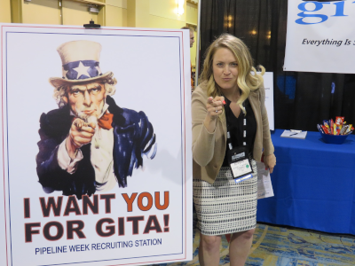
Educational Services: GITA regularly hosts, sponsors, or participates in several annual or semi-annual events. Notable events include: our annual Pacific Northwest Conference held in Mukilteo, Washington, (suburban Seattle); our energy focused GIS conference known as “EnerGIS,” held annually in suburban Pittsburgh, Pennsylvania; UMGEOCON, which focuses on geospatial activities within the upper mid-west; and our annual “Pipeline Week” conference in Houston, Texas, which spotlights the geospatial needs of the oil and natural gas pipeline transmission industry. GITA is also a proud sponsor of GoGeomatics’ “Back to School Socials,” a Canadian outreach to geospatial students.
Over the past several years, GITA has found that webinars are a highly cost-effective outreach. Current GITA President-elect, Drew Fioranelli, has recruited a number of notable geospatial professionals to share their experiences and insights with the broader community. Drew presents these webinars in a lively format. The best part is GITA provides these free to the community; additionally they are recorded so that can be listened to at a later point via GITA’s on-line learning center.
The GITA Learning Center itself is a marvel! PowerPoint presentations, previous webinars, and YouTube videos of conference proceedings are stored, indexed, and easily found via our on-line search tool. Readers should visit http://www.gita.org/search/all.asp, merely enter a search term such as “coal” or “pipelines” or “national grid” and links to various educational resources are made available to anyone in the geospatial community.
GITA maintains strong ties to the academic community; this is especially seen in the funding provided to geospatial students. In 2017, GITA North America and its regional chapters provided over $10,000 dollars in scholarships. Notably, since 2014 GITA’s The Mid-Atlantic Chapter through its EnerGIS conference has distributed over $23,000 in scholarships and $3000 for local food banks.
Advocacy: Serving as an advocate for our members is an important mission for GITA. GITA has the opportunity to nominate and recommend candidates for the National Geospatial Advisory Council (NGAC), and has representatives that sit on the board of the GIS Certification Institute which evaluates and tests the abilities of geospatial practitioners and awards successful candidates with the GISP (GIS Professional) certification.
 GITA also serves as a lobbying agency for our members. Over the past two years, the hotly debated “Geospatial Data Act of 2017” and similar state efforts have consumed a large portion of the association’s efforts. The proposed legislation and similar bills in the various state legislatures would place the work of GIS practitioners and GPS users under the auspices of professional engineers and licensed surveyors. As of this writing, GITA has been successful in conjunction with our industry allies to stymie these efforts, at both the federal, and for the most part, at state levels. Protecting the dynamic geospatial industry and our members’ ability to provide innovative, independent solutions and services to their clients is a primary goal of GITA!
Current Business Model: As the industry has changed and matured so has GITA. By 2011, in response to industry challenges, GITA was in need of a reboot. The association restructured itself as a volunteer- based organization. Rather than overseeing a large in-house management staff, the board collaborates and works with our contractor SharedGeo (https://www.sharedgeo.org/) of St. Paul, Minnesota. SharedGeo functions as the “back office” for the association providing, IT, membership, and event planning services for the association. Relieved of the burden of maintaining a full-time staff has allowed GITA to provide services to our members in a highly cost-effective format.
Membership in the organization is still very reasonable compared to other industry associations or trade associations; individual memberships start at $150 and corporate affiliations may be purchased for as low as $500.
Involvement: As with any volunteer organization, GITA is in need of active and involved professionals who want to make a difference in the industry. Volunteers are needed to help promote the association via social media, assist with conference planning, and recruit new members and affiliates. One of the greatest challenges I’ve faced as President is recruiting younger practitioners, especially those with five to ten years’ experience to get involved with association activities.
Unfortunately, any organization cannot only rely on the senior veterans to keep things going. I’d encourage younger professionals to get involved; your insights, passion, and energy are needed! It seems today everyone has an excuse. Well, you’re busy, I’m busy, my Board of Directors is busy, we are all busy! Young professionals, it’s time to step it up. Non-involvement also has a lost benefit cost, especially in a lack of networking and speaking skills. Involvement with GITA reflects well, not only on yourself and your professional skills, but also reflects well on your employer and their contributions to the geospatial industry.
Please consider joining our efforts to keep GITA relevant and growing – not only for your career but for the good of the geospatial industry.
Mark E. Limbruner, GISP has over 36 years of mapping, CAD and geospatial experience within the petroleum exploration, environmental engineering, GIS consulting, and coal mining industries. Since 2008 Mark has been employed as the GIS Manager for Range Resources Corporation’s Appalachian Division. He has served as a director of the Geospatial Information & Technology Association (GITA) since 2013, and it’s President since 2015. Feel free to reach him at
president@gita.org
Check out this handpicked feature on The Aluminum Association of America.
AT A GLANCE
WHO: Geospatial Information & Technology Association
WHAT: A professional trade association
WHERE: St. Paul, Minnesota
WEBSITE: www.gita.org
DIG DIGITAL?

July 2018